Back to AlertsWinter Storm Watch
Posted 03/10/22
Overview:
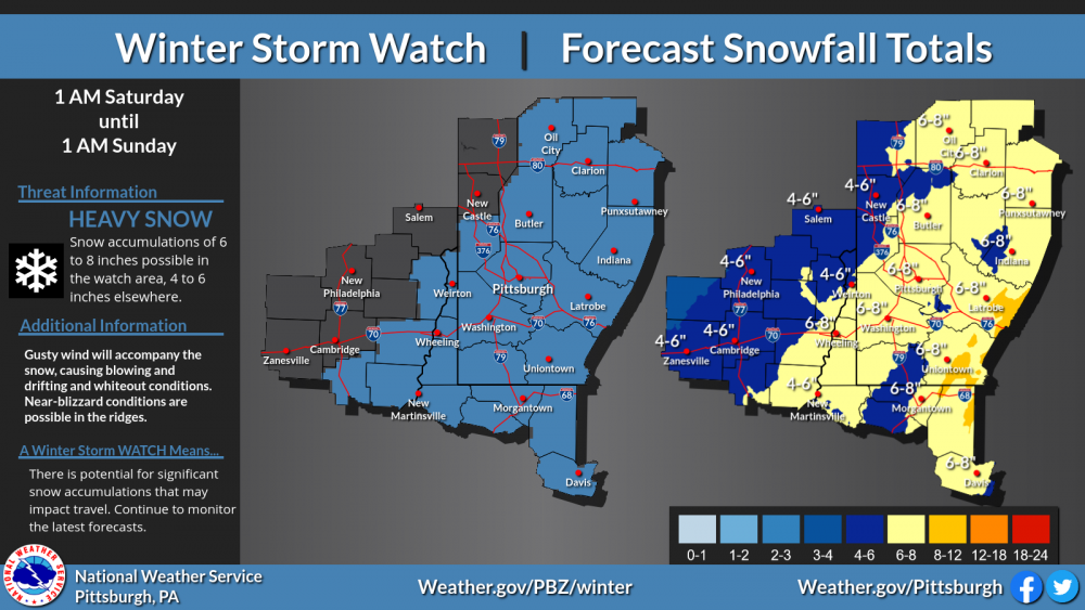
Rain will transition to snow Friday night, with widespread accumulating snow expected through Saturday.
|
TIMING
|
- Friday night through Saturday evening.
|
|
HAZARDS & IMPACTS
|
- Widespread accumulating snow is expected Friday night through Saturday. Total accumulation of 6 inches or more is possible in the Watch area, with 4 to 6 inches elsewhere.
|
|
NWS ALERTS
|
- Winter Storm Watch for northern WV, much of southwest PA, and portions of eastern Ohio.
- Additional headlines will likely be need in areas outside the Watch.
|
|
FORECAST UNCERTAINTY
|
- High Confidence in the ridges.
- Medium Confidence in the lowlands. Snow totals will depend on how early/late the transition from rain to snow occurs.
|
|
ADDITIONAL INFORMATION
|
- Additional headlines will likely be needed across the forecast area.
- Please visit our website and other social media outlets for the latest updates.
|