Subscribe to Stay Informed
Back to Alerts
Flood Watch Issued into Monday Afternoon| Severe Thunderstorm Threat Continues for Monday
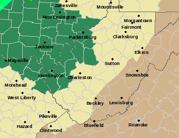
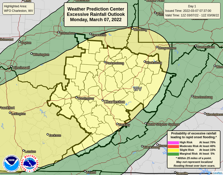
Posted 03/07/22A flood watch has been issued for much of western WV, and portions of southeastern Ohio and northeastern Kentucky. Much of the region remains under a slight risk for excessive rainfall through tomorrow afternoon/evening, with severe thunderstorms also possible tomorrow.
Overview
- What: Excessive rainfall may lead to water issues. Severe thunderstorms with damaging wind gusts possible.
- When: Excessive Rainfall: Possible tonight through Monday evening. Severe Weather: Most likely Monday afternoon into the evening.
- Where: Area-wide.
Summary
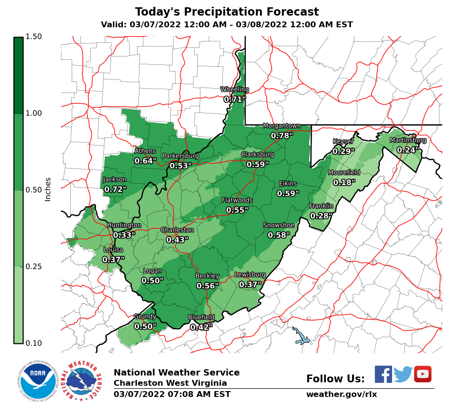
- A line of showers will slowly move north tonight. Could have localized water issues, especially in areas that have already had some heavy rainfall.
- An approaching cold front on Monday will result in the potential for severe thunderstorms across much of the region, with the main threat being damaging wind gusts.
- In addition, water issues could also occur Monday in areas hit by heavy thunderstorms and/or repetitive rounds of rain, especially for the areas that have received heavy rain fall in today's first round.
Flood Watch into Monday Afternoon:
Severe Weather Outlook:
Today's Precipitation Forecast: